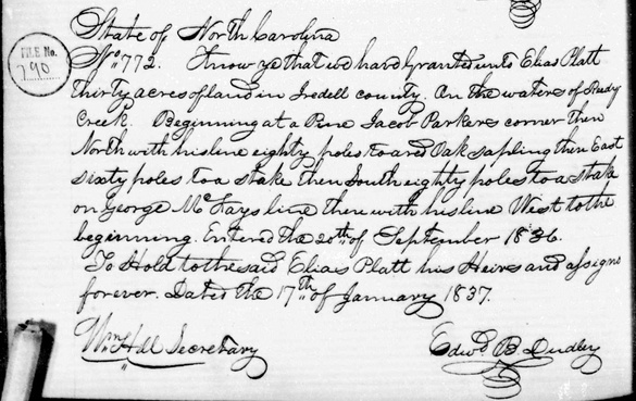
Iredell County - Elias Plott
Land Grant
I have not found a Land Grant Deed for the following entry for 30 acres on the "On waters of Ready Creek", File #790, "17th day January 1837".

Click on the below green button to open, read, save and/or print or HERE.
Elias Plott as Grantee.
At this time, the Iredell County grantee deed list does not record Elias Plott; however, records his son, Elias W. (Wagner) Plott.
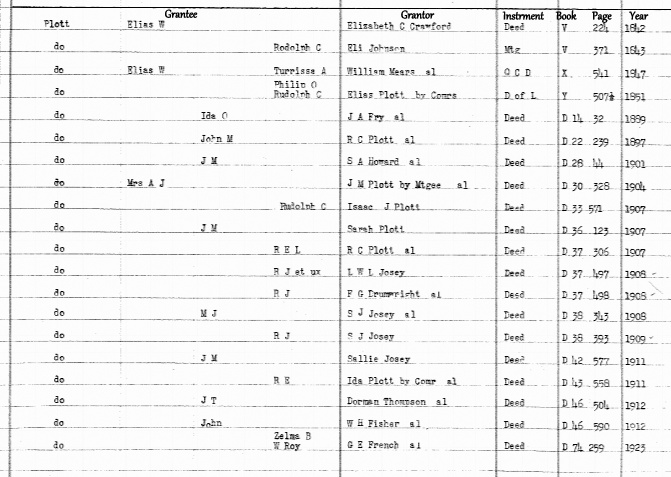
Elias Plott was not logged on this registry as grantee. Elias W. (Wagner) Plott was the son of Elias Plott.
Elias Plott as Grantor.
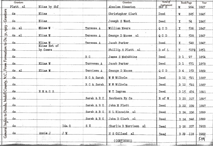
Elias Plott was the father. Elias W. (Wagner) Plott was the son. This page is reporting the deed pertaining to Elias Plott, the father.
|
|
|
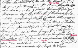
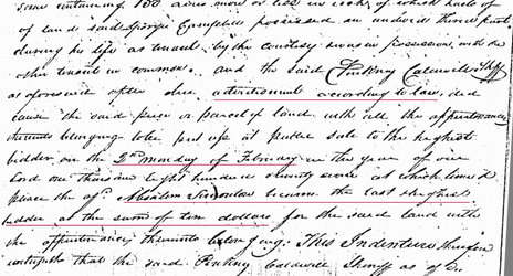
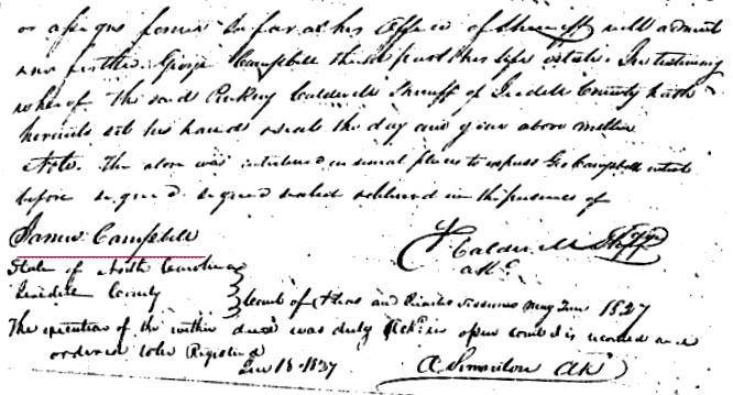
The below file is the Sheriff Deed Sale file from Elias Plott and George Campbell to Absolom Simonton; Iredell County, NC.
"after due advertisement according to law" I have not found a newspaper advertisement sale notice for the property.
"public sale to the highest bidder on the 2nd Monday of February in the year of out Lord one thousand Eight hundred twenty seven at which time & place ____ ____ Absolom Simonton became the last highest bidder at the sum of ten dollars for the said land".
The witness to the deed was James Campbell. I need to verify who this James Campbell was. Unknown at this time.
Click on the below green button to open, read, save and/or print or HERE.
The below file is the Deed File for Elias Plott to Christopher Clark; Iredell County, NC. This deed proves that Elias Plott was still alive in February 1845.
"This Indenture made this the 20 day of May in the year Eighteen Hundred and forty four."
"the sum of ninety dollars" $90.00
"Houston's Corner running then East 4 poles with said Houston's line", "Estimation Six acres"
Click on the below green button to open, read, save and/or print or HERE.
"This Indenture made this the 20 day of May in the year Eighteen Hundred and forty four."
"the sum of ninety dollars" $90.00
"Houston's Corner running then East 4 poles with said Houston's line", "Estimation Six acres"
Click on the below green button to open, read, save and/or print or HERE.
The below file is the Elias Plott to Joseph S. West; Iredell County, NC. This deed proves that Elias Plott was still alive in June 1845.
"This Indenture made this the 21st day of June in the year Eighteen hundred and forty five"
"in the consideration of the sum of Sixty nine dollars" $69.00
"containing thiry acres on the waters of the Catawba River"
Click on the below green button to open, read, save and/or print or HERE. Under construction.
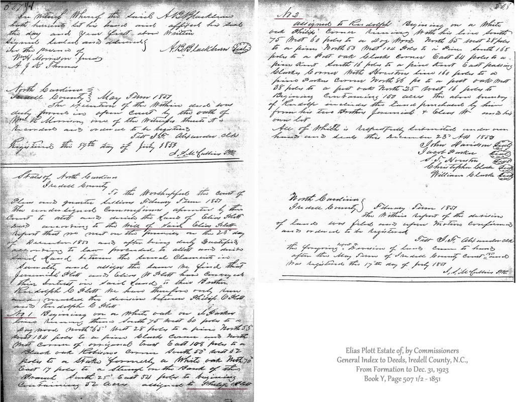
The below file is the deed from the Estate of Elias Plott to No. 1 parcel to Philip O. Plott and No. 2 parcel to Rudolph C. Plott; Iredell County, NC.
"State of North Carolina, Iredell County
To the Worshipful the court of Pleas and quarter Sessions February Term 1851 the undersigned commissioners appointed by the decd. according to the Will of Said Elias Plott report that we met on the premises on the 23rd day of December 1850 and after being duly Qualified according to law proceeded to allot and divide Said Land between the several claimants in Severalty and assign the same we find that Jeremiah Plott and Elias W Plott have conveyed their Interest in Said Land to their Brother Rudolph C. Plott. We have therefore only run and marked the division between Philip O. Plott and Rudolph C. Plott."
"No. 1" was assigned to Philip O. Plott. This property was on the J. Parker line. Please see the above land grant to Elias Plott, which describes "Jacob Parker's corner."
"containing 52 acres."
"No. 2" was assigned to Rudolph C. Plott.
"containing 150 acres the above boundary of Rudolph includes the land purchased by him from his two Brothers, Jeremiah & Wlias W. and is own lot.
Total of 202 acres.

|
Copyright 2016. All rights reserved.
|